Saturday, January 28, 2017

Making lemonade again (Part I)

I think the theme of making lemonade from lemons might just be a recurring series on this blog. You might recall last year that I had to make the most of a dry spell by looking for new locations and new perspectives to make the most out of some slim railfanning choices up here in Ottawa. Last summer, I gave a lot of thought to some shots I wanted to get on the Smiths Falls Sub and I managed to get some interesting rail photos as a result.

Making Lemonade Part I
Making Lemonade Part II

This past weekend, I found myself in Smiths Falls and was looking forward to catching something interesting in the yard or on the main line. Unfortunately, I probably chose the worst possible time to visit the yard as it was largely empty and no freights seemed to be forthcoming, judging by the signals.

This is what I saw:


Deep in the yard, CP GP38-2 3089 and GP20C-ECO 2279 were idling, although they didn't move when I was there. Likely they were just keeping warm in the cold weather until they were needed.

Other than that, there were maybe 20-30 tank cars and a few cylindrical hoppers. EHH's CP is not terribly interesting, even with the man now gone and setting his sights on CSX.


Nothing special in either shot, but the tank car shot gives you an idea of the curvature of the Smiths Falls yard, which offers some great opportunities for photographs, if only something in the yard is moving!


As I said, there wasn't much to look at or shoot while I waited for a train. There was an assortment of MoW equipment, but it was quite far off.


After I shot all the obvious items I could, I began to think about whether there were some obvious details I might be missing. It turned out, there was something staring me right in the face. Along the track closest to the old Smith Falls Via Rail station, some signaling equipment sat on the ground, begging to be included in a shot.

This was the result.


Compare that shot to the top shot. I was much happier with this shot. It gave me a more dynamic visual. It also got me thinking about the morning Via from Ottawa, which was due to make its way through the yard.

So I began to put some elements together in my mind. I could take advantage of the curvature of the track on either side of the yard and I wondered whether I could bring together the Via corridor train with the two geeps idling in the yard.

There were some challenges, the most obvious being that the geeps were quite far from where I was standing, but I had to try something because it appeared as though no freights were imminent.

I'll save the rest for next week.

Saturday, January 21, 2017

Winter observations in Ottawa: New mileage!

I found my way to the east end of the city this weekend, which gave me a chance to look at the progress being made on the O-Train Confederation Line and the renovations to Via Rail's Ottawa Station.

The most interesting site was at Belfast Yard. I don't know when railfans in Ottawa can claim to have seen new rails put it place in this city, other than the odd siding or such installed by Via Rail recently. What you're seeing below is a small section of the Confederation rail line as it enters Belfast Yard, the site where the new electric Alstom Citadis Spirit trains are being assembled and tested. If you look closely, you can see the catenary over the rails and the signals.

Those who are following the progress of this phase of the LRT project know that the city held a press conference recently around Cyrville Road, where they showed off an assembled trainset that was being tested on the tracks.


Here's another shot, below.


Both shots were taken from the Belfast Road overpass, facing east. Unfortunately, since the west sidewalk is the only vantage point that is walkable at this time of year, I was unable to get a shot from the east side, which would have minimized the impact of the fencing that was hindering my shots.

You may recall that I got a peripheral shot of the construction of this facility a few years back when I was shooting an incoming corridor train at Ottawa Station. The shot below gives you an idea of where Belfast Yard is relative to the station. Those cranes were assembling the Belfast facilities at the time. In some respects, the LRT yard is a next door neighbor to Via. The shot below shows a westbound train from Montreal coming in to the station in January 2015.


As you walk over the Belfact overpass, you can see where the Confederation Line dips below both the overpass and the Alexandria Sub trackage leading into the Via station. It's hard to photograph where the lines cross over, since no sidewalk access on the east side of the overpass prevents a good shot, so that will be for another day.

By all accounts, the O-Train project is progressing smoothly. This past year saw a few delays, one of which was caused by a massive sinkhole on Rideau Street in the downtown in late June, which flooded the O-Train tunnel and trapped a few workers for a short time. The sinkhole was fixed quickly, but the questions over how this hole formed are likely not going to be answered for some time. The last report I saw suggested that the tunnel was not a major factor.

The new line is slated to open next year. While the existing O-Train Trillium Line continues to operate normally with diesel Alstom Coradia LINT sets, the new Confederation Line construction is already having an impact. When the Confederation Line opens, the O-Train's existing Confederation Station, seen below, will likely have to be renamed to avoid confusion. This station , seen below, is named after the Confederation Park business park it serves, which includes a number of federal government buildings and Canada Post.


The debate over what to call the bus/train commuter stop at the Via Rail station was settled remarkably quickly, which surprised me. The stop, which went by the name Train, will now be called Tremblay Station, since the Via Rail station is on Tremblay Road.

Speaking of the Via Rail Station, I did manage to snap a few shots  of the action Saturday morning through the fog. The tracks were pretty full, judging by this shot I took from the Belfast overpass.


The fog really didn't help my cause from this vantage point. The wires are still a pain, too! But if you look, you'll two trains the south track (left) and two more on the right side of the picture. There is one on the centre track, hiding beneath the canopy. That's five trains at the station at once. That P42 is just about to leave for Montreal.

A little later, I drove down Belfast Road and was able to get up to the fence by the tracks to get this shot of two generations of Via diesels. The new diesel, P42 904, has the old blue and yellow paint while the older unit, F40 6446, has the new scheme. Those paying attention would notice that 6446 was the same train in the shot I shared above from January 2015. I was lucky that a huge snowbank allowed me to get a little elevation and get a shot over the chain link fence.


Just about a minute after I got the family shot, 6446 was on its way to Toronto, as seen below.


I didn't notice a whole lot of work being done on the platforms (read about the station renovations here), but there were some construction vehicles and some boarded off sections of the platform, which at least suggests that work has started in some spots to raise these platforms and enclose them from the elements.

I just hope the renovations don't ruin the vantage points from local rail enthusiasts.

Saturday, January 14, 2017

Looking for some railway history

Chances are, you can take just about any town in Canada without rails and find some sort of railway influence in its past. Even now, in communities where railways still pass through, you will likely find a much more extensive railway past.

This year, I hope to dig up some more rail history as part of my meanderings here on the blog. In the coming months, I am hoping to share some photos and thoughts about some historic railway towns here in the Ottawa Valley. I am hoping that some of my blog's readers who live in the Ottawa area can make some suggestions for some piece of local rail history they would like to see me approach.

As an example, I am putting together a post about Almonte, which is a beautiful town west of Ottawa that was once served by the Canadian Pacific's Chalk River Sub. I am proud to say I have witnessed action along this old rail line in Almonte.

With that in mind, I thought I'd share some interesting photos that will kick off Beachburg Sub's Year of Rail History. Since this year marks Canada's 150th birthday, I think it's only fitting that we take a couple looks back and celebrate our history.


This photo above is a shot of Mooretown's old Pere Marquette railway station, which was saved for the museum after it was moved from its spot on the St. Clair Parkway where it was used as a private home. The station itself was sold off for use as a home when it was deemed redundant to the railway at some point. In 1988, the family living in the old station moved to a larger home so the station was moved to the Moore Museum grounds, just down the road from the tracks.


Of course, Mooretown's train station is a success story. Some locals obviously felt the old station should have been saved, so they loaded it onto a large trailer and brought it from its spot on the river and to the museum. The image above is from the Moore Museum. It was sent to me by a reader, but I don't know much about the circumstances of the move. This is only one of two stations to survive along this old rail line, the other being the Dresden station.

Of course, many other buildings on the Sarnia Subdivision were not so lucky. For a time, CSX kept a trackside shed in Port Lambton, which bore the town name. That trackside structure was sold to a local resident and used in the family's back yard as a shed.

The other day, I saw a larger shot of this timetable on one of my Facebook railway groups, which began to get me thinking about history.


As you can see, there were once eight passenger trains plying the Sarnia Subdivision. This is not surprising, since railways were the main mode of transportation between towns before cars became the dominant mode of personal transportation.

But what I found interesting is how many stops these passenger trains made. For example, in my hometown, Corunna, you had four trains a day, two northbound and two southbound. I am determined to find out more about passenger service on this line, particularly when it ended. I am guessing it was discontinued shortly after the Second World War, but it may have been sooner.

My hometown is a place with almost no visual history remaining. There are possibly two or three Confederation era homes left in the town and one church, built in 1862, but that's it. The rest of the town appears as if it was thrown together after the 1960s. I would love to find out more information about my hometown's train station. This timetable is the first document I have seen that proves there was some sort of passenger station (or possibly shack) in Corunna.

Closer to my current home, I recently uncovered two references to two railway stations in Bells Corners. I am pretty sure the old CN station was located behind the fence in this picture, where Northside Road meets Cassidy Road (Cassidy Road used to be part of Cedarview Road).Sadly, it was not saved. In fact, Ottawa had many more stations scattered around the city but none were saved, except the old Union Station downtown.


I also read a reference to the other Bells Corners railway station, which was located along the old Canadian Pacific Carleton Place Sub (now a recreational trail) along what is now known as Fitzgerald Road. I wasn't able to find anything more specific as to where the station was. What makes this task so tough is that there is very little online about the history of Bells Corners (same problem with Corunna).


This is a shot of the old Carleton Place Sub. The station would have been located somewhere on the right side of the trail. My goal this year is to try and find out where the old station was located.

So, that is my mission for this year. I welcome any suggestions from anyone out there as to what they might want me to research. Hopefully, we can shine a light on some long forgotten railway relics this year.

Saturday, January 7, 2017

Guest post: The railway spur with a little of everything

My brother recently caught up to a tiny train on CN's Point Edward Spur in Sarnia's downtown. I asked him to share a few thoughts about what makes this rail line such an anomaly in today's railway industry. - Michael

There is an old, and lightly used spur that connects Sarnia’s main yard to the government docks on Sarnia’s harbour. The harbour is used to berth ships for major overhauls and winter repairs. (insert sentence about the elevator?)

I was downtown on my lunch, and heard the horn of an engine on the spur. It’s a loud sound in a quiet downtown. I made my way to Front Street and followed the train, stopping along the way to take a few shots. It’s a rare sight to see trains on this spur. My friends who live in the area tell me it’s a few trains a week, during high season. I just missed the train crossing the road.

Shot looking South, at the South crossing on Front Street, approaching London Road. Engine pair is heading away from me. Sarnia’s “Celebration of Lights” has a locally famous display during the December evenings. Note the displays in the park.


The track heads down, and the road continues up on the ridge.  There are many places to catch trains on this spur, as it winds its way through downtown.Continuing South, running in behind the SNC Lavalin building. SNC has a large engineering presence supporting Sarnia’s Chemical Valley.


On the other side of the SNC building, the pair emerged. No Photoshop here, Sarnia has some of the most beautiful blue waters in Canada.


I continued down Front Street a few blocks, aiming to hit Ferry Dock Hill (betwwen Cromwell and Davis St). Ferries no longer arrive here, but it’s a name going back to Sarnia’s major port history, where passenger and freight ships would arrive here.  This old spur has a lot of history, as Sarnia’s waterfront used to house a Salt Works, Lumber Mills and some small scale petrochemical industries. 
The trains on this spur travel so slowly, it’s easy to get ahead of the train, even when you hit red lights.

I like the mix of old/new here: The first tower in the centre of the shot is a condominium building. To its left is an office tower. To the immediate right of the locomotives, you see some old brick buildings that are still fairly typical in Sarnia’s downtown.  In the background (behind the engines) you see the famous “boat building”. An apartment high rise built in the 80s as a nod to Sarnia’s nautical history.

Many of Sarnia’s historical buildings have been lost in the name of “progress”, and some due to the tornado that ripped through in 1953.


As you will see, this track is not protected, and is surrounded by a beautiful park, walkways, office buildings, parking lots and uncontrolled crossings. I have not heard of any problems, due to low traffic volumes, slow train speeds and residents that understand the rules. All my shots were well off the railway right of way.  My meeting was by chance, so all I had was my phone and a cloudy day.
Looking South, as the pair heads back into the Sarnia yard. You can see the gravel docks down, and to the left. This site used to house the CN Ferry for oversized cars. That ferry was used until the opening of the new Sarnia - Port Huron tunnel.

You can also see the stacks from Imperial Oil, one of Sarnia’s oldest and largest employers. The Riverport is seen to the left, on Front St.  A “Gentlemen’s Club” so I have heard.


Thanks to my brother Marc for a quick tour of this fascinating little spur. I think these photos are another example of something I've been trying to do all year. These shots blend in with the train, placing it in context. The real story here isn't necessarily the train, but the somewhat unique surroundings for this rail line. A throwback for sure. Below is one more shot that I threw in since I thought it was a cool shot.  - Michael


Earlier posts

CN's Point Edward spur today
The path through the downtown: the Point Edward spur

Monday, January 2, 2017

The original Carleton Place Subdivision in 1966-67

Canadian Pacific's history in Ottawa goes back to the late 1800s, although there isn't much that the casual observer will see of the railway's legacy in this city today. However, if you dig deep enough, there are some fascinating hints of Canadian Pacific's past in Ottawa, including a number of spots where you can spot the old Carleton Place Subdivision, a line that dates back to 1870 when it belonged the broad-gage Canada Central Railway. Let's go digging.

The Carleton Place Subdivision was brought under the CP umbrella in 1881, after it acquired the operations of the Canada Central Railway, a road that stretched from Brockville to Mattawa in the Upper Ottawa Valley at the time (that main line was originally the Brockville & Ottawa Railway before it merged with CCR). The Carleton Place Sub essentially connected Ottawa to the Brockville-Mattawa main line, which ran through Carleton Place.

For our purposes, we are going to focus on the modern history of the Carleton Place Sub, which connected CP freight trains and passenger trains (later Via Rail passenger trains) with CP's Chalk River Subdivision and points west on CP's transcontinental main line.

Photo from the Canada Science and Technology Museum online archives

We'll start on the east end of the subdivision as it was before it was ripped up. If you travelled on this sub as it was originally laid out, you would have boarded a train at the Ottawa West train station, on the western fringes of the area known as the LeBreton Flats, just west of Ottawa's downtown core. This station was a bit of an anomaly, as CP at one point didn't use the city's main Union Station downtown for its transcontinental passenger trains (They did in fact stop at Union Station, according to a reader, see below). This changed, of course, when the downtown station closed in 1966 and a new station opened on Tremblay Road. I was told by a local rail historian that the Union Station accommodated CP's corridor trains but the pictures I have seen of the Ottawa West station clearly show the Dominion and the Canadian both used this as their Ottawa stop. I'm not sure why this arrangement was made.

This is what the CP operations looked like at the eastern end of the Carleton Place Sub in an area generally known as Bayview.


The red line shows you the general direction of the current O-Train Ellwood Subdivision, although the line is no longer continuous through to the Prince of Wales Bridge (light blue arrow, top of image. The blue line (bottom left) shows you the beginning of the old Carleton Place Subdivision as it left Ottawa West station (red arrow). The right-of-way is now the Transitway, a road reserved for the city's express commuter buses.

Just about all traces of this scene are gone now, although in the bottom right corner, you will see a green arrow and purple arrow. Both of these buildings still stand. One is a former truck facility that is now home to the City Centre plaza, a unique collection of artisan shops and eateries. The purple arrow shows you an old CP office building, which somehow survived years of redevelopment. It is now home to an art gallery after languishing for years.

From Ottawa West yard, it was a short trip west to Westboro, a now tony subdivision, which once had its own train station at the end of Roosevelt Street, situated on what is now the Transitway.


The spot where the station once stood is now a trench where the Transitway passes through. You'd never know a station once stood here, if you didn't know the history of the Transitway.

This shot above, taken in 1952, shows the Westboro station as it stood in its prime. By the time the NCC's vision for Ottawa began to change the face of Ottawa in 1966-67, this station was doomed. It was torn down shortly after this part of the Carleton Place Sub hosted its last freight train in the fall of 1967. By this time, passenger service through Westboro was already history, as the final Canadian passed by the neighbourhood in 1966.

Here's what the right-of-way looked like in 1965. Today, this right-of-way still exists, but it now exists as a trench that hosts a two-lane bus express road, known as the Transitway. That road was constructed in the early 1980s and was officially opened to buses in 1983. The red arrows show you the right-of-way in its final years. The yellow arrow  shows you Ottawa West station where the subdivision started. Toward the bottom of the image, the blue arrow shows you a small spur. I'm not sure if that was a CP customer or if it was a rail shed, which was once located near the old Westboro station.


Below you will find a view of 3105 Carling Avenue, also in 1965. Although much has changed since then, it's still easy to see this former crossing, now part of Trans Canada Trail. Just look for the pedestrian crossing near Andrew Haydon Park. That's the old Carleton Place Sub.


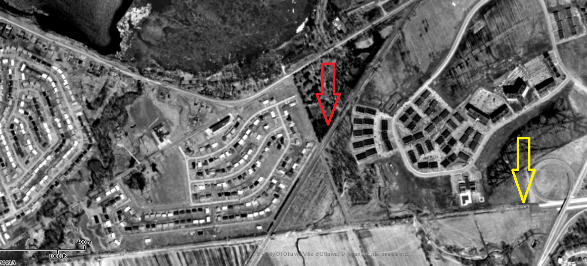
The shot below shows you what was then known as Acres Side Road in 1965. The road is now known as Holly Acres Road and is pretty much a feeder road between Carling Avenue and Richmond Road. In the shot below, you can see the old right of way, where the red arrow is pointing. The yellow arrow shows you where the Queensway ended at the time. Of course, the 417 goes all the way to Arnprior now and much further as Highway 17. Just to the left of the red arrow is the beginnings of one of Ottawa's more notorious neighbourhoods, Bayshore, although the area has been cleaned up significantly in recent years.


Past Bayshore, the old Carleton Place Sub passed through farmland before reaching Bells Corners. When it reached this neighbourhood, it crossed beneath the CN Beachburg Subdivision. The shot below shows you what the crossover looked like shortly before it was scrapped. In its place, CP trains were marshalled west in Ottawa over the Beachburg Sub until they hit Bells Junction in Bells Corners. This junction is just east of Moodie Drive an it served as the new beginning of the Carleton Place Subdivision.

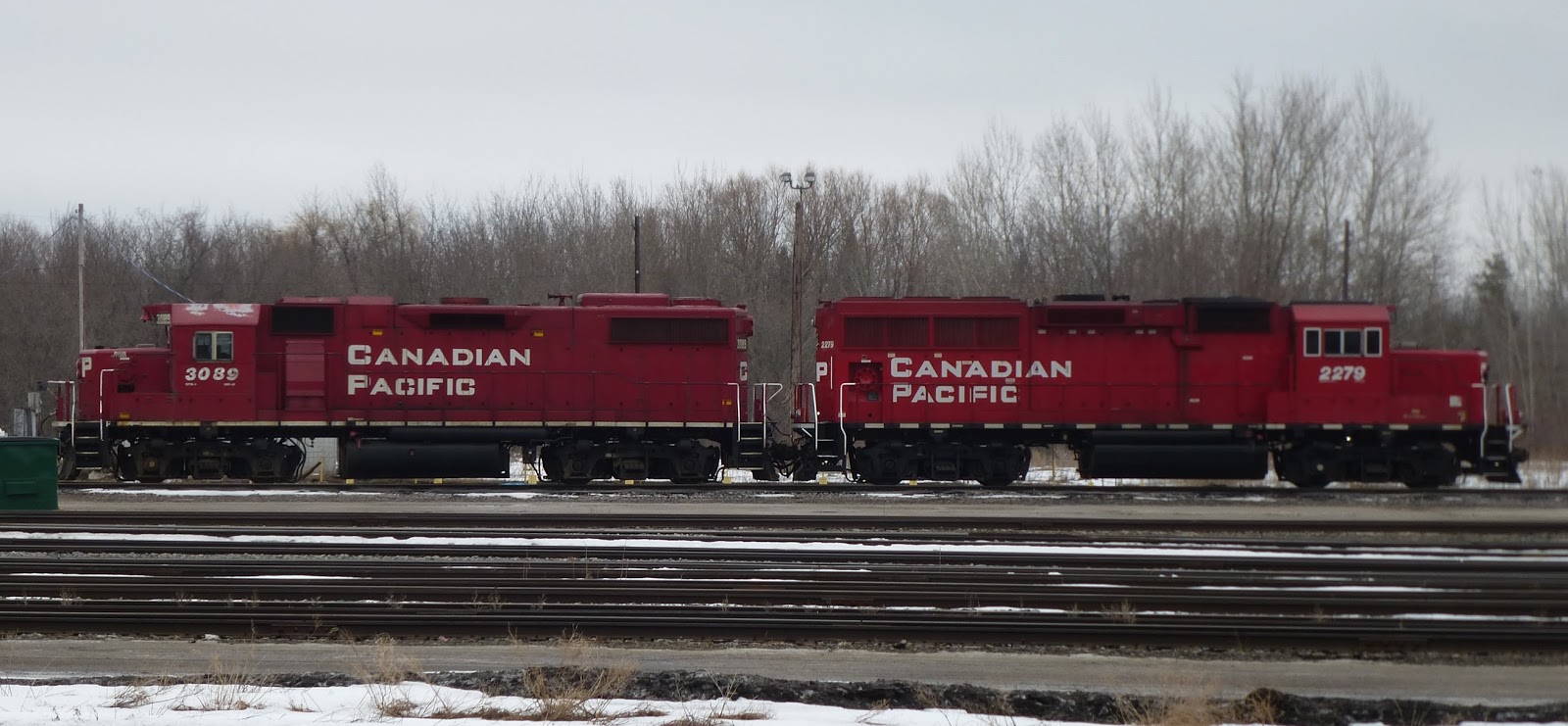
Photo from the Canada Science and Technology Museum online archives. Check out those railfans trackside! You can't get that close to the rights of way now.

I played around with a few title ideas for this post, which has been in development for more than a year. It really seemed like the 1966-67 timeframe was the last gasp for railways in Ottawa. This line, of course, was of little strategic importance to CP east of Bells Corners, so the junction idea seems like a reasonable compromise, even in retrospect. But given how useful these old lines could be for Ottawa's light rail ambitions now, it makes you question when rails are ripped up and when no one does a thing to preserve the rights of way for future use.